Introduction
Soil Explorer
CLORPT Model
Climate
Organisms
Relief
Parent Material
Time & History
Soil Orders
Soil Texture
Soil Chemistry
Serpentine
Explore

A Landscape Born from Fire and Time

In southern Oregon, where the ancient Klamath Mountains and the Siskiyous meet the volcanic Cascades, lies a remarkable testament to geological complexity: the Cascade-Siskiyou National Monument.

This unique landscape tells a story written in soils—a story of ancient ocean floors thrust skyward, volcanic eruptions that shaped the land, and millions of years of weathering that created some of North America's most distinctive soil ecosystems.

114,000 acres protected (Source: BLM)
7 soil orders present (Source: SSURGO)
300+ plant species (Source: BLM)
Cascade-Siskiyou National Monument landscape view
The Cascade-Siskiyou National Monument spans the convergence of three major mountain ranges, creating a complex landscape of diverse soils and ecosystems Photo: BLM Oregon

Interactive Soil Data Explorer

This web application brings professional soil survey data directly to your browser, making complex soil information accessible through an intuitive, interactive interface.

Inspired by UC Davis SoilWeb, this application transforms USDA-NRCS soil survey data (SSURGO) into an engaging exploration tool. The interface provides multiple ways to visualize and understand the monument's soil resources:

Multiple Map Views:
Switch between soil orders, particle classes, chemistry, and environmental factors
Interactive Exploration:
Click anywhere to see detailed soil profiles and classifications
Depth Analysis:
Explore soil properties at six different depth intervals
Overlay Comparisons:
View boundaries, roads, and points of interest alongside soil data

Educational Soil Mapping

This application demonstrates how sophisticated soil information can be made accessible to students, researchers, and the public through modern web mapping technologies.

Interactive soil explorer interface showing SSURGO soil data for the monument
Monument Soil Explorer: An interactive web application for exploring soil survey data, showing detailed map unit boundaries and soil classifications across the monument

CLORPT: The Recipe for Soil

S = f(cl, o, r, p, t)

(The "L" is silent—"cl" represents climate)

In 1941, soil scientist Hans Jenny revolutionized our understanding of soil formation with this elegant equation. CLORPT reveals that soils are not random but predictable products of five state factors.

Cl Climate
O Organisms
R Relief
P Parent Material
T Time

In the Cascade-Siskiyou National Monument, these five factors interact in extraordinary ways, creating one of North America's most diverse soil landscapes. Let's explore each factor to understand how the monument's soils came to be.

Climate: The Master Sculptor

Climate acts as a primary driver of soil formation, controlling the rate of weathering, organic matter decomposition, and the movement of materials through the soil profile.

The monument experiences a Mediterranean climate with distinct wet winters and dry summers. Annual precipitation ranges from 20 inches in rain shadow valleys to over 60 inches on exposed ridges. This seasonal moisture pattern creates unique soil-forming conditions. Additionally, the complex topography creates diverse microclimates that further influence soil development:

Winter leaching (specific soils):
Heavy rains move clays and nutrients deeper into the soil profile
Summer drying (specific soils):
Creates cracks and concentrates salts at the surface
Temperature fluctuations:
Freeze-thaw cycles break down rocks and minerals
Elevation gradients:
Every 1,000 feet of elevation equals ~3°F temperature change
Annual
Precipitation
[mm]
-
-
-
-
-
30-year precipitation normals. Precipitation varies dramatically across the monument, from 18 inches (459mm) in valleys to 57 inches (1460mm) on mountain peaks.

Temperature Gradients

Mean annual temperatures range from 5.9°C (43°F) at high elevations to 11.7°C (53°F) in low valleys. Summer drought conditions and winter moisture create unique soil weathering patterns and influence which plant communities can thrive.

Sunrise over the monument
Mean Annual
Temperature
(°C)
-
-
-
-
-
Mean annual temperatures decrease with elevation, creating distinct climate zones that control soil formation rates and vegetation communities.

Organisms: The Living Soil

From towering conifers to microscopic bacteria, organisms are the biochemical engines that transform minerals and organic matter into living soil.

The monument hosts over 300 plant species, each contributing to soil formation in unique ways. The monument's position at the convergence of major ecoregions creates exceptional biological diversity that directly influences soil properties:

Forest Ecosystems

Conifer needles create acidic conditions, accelerating leaching processes

Grasslands

Dense root systems build deep, carbon-rich A horizons characteristic of Mollisols

Soil Microbes

Billions of bacteria and fungi per gram decompose organic matter and cycle nutrients

Serpentine-Adapted Plants

The monument's ultramafic (serpentine) soils host numerous endemic plant species that have evolved tolerance to challenging soil chemistry. These serpentine-adapted species demonstrate remarkable plant-soil relationships. (USFS Rogue River-Siskiyou)

Land Cover
Open Water
Perennial Ice/Snow
Developed, Open Space
Developed, Low Intensity
Developed, Medium Intensity
Developed, High Intensity
Barren Land
Deciduous Forest
Evergreen Forest
Mixed Forest
Shrub/Scrub
Grassland/Herbaceous
Pasture/Hay
Cultivated Crops
Woody Wetlands
Emergent Herbaceous Wetlands
The diverse vegetation communities across the monument both reflect and influence soil properties. From oak woodlands to alpine meadows, each vegetation type contributes unique organic matter and influences soil chemistry.

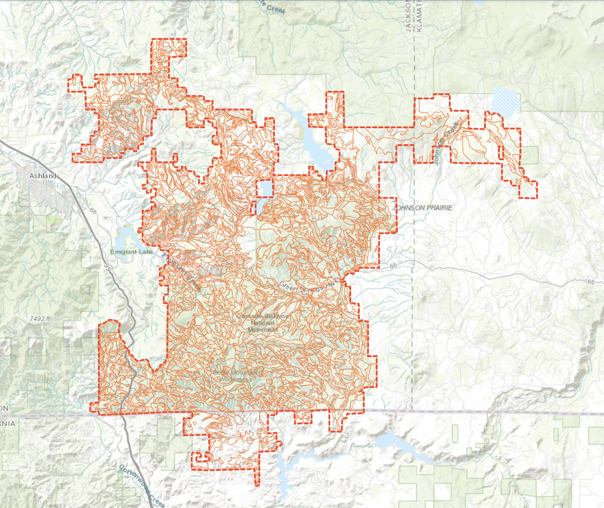
Relief: Gravity's Influence

Topography controls how water moves across and through the landscape, determining where soils erode, accumulate, and develop distinct characteristics.

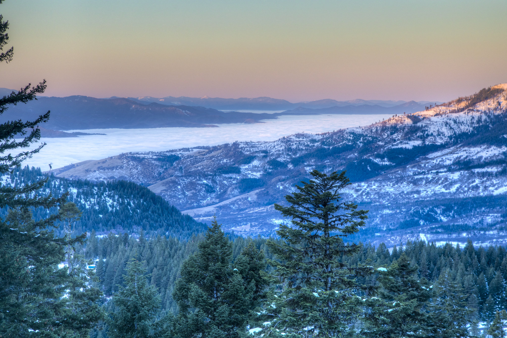
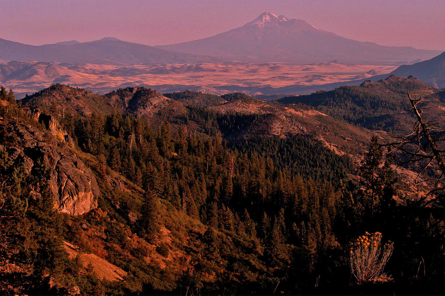
With elevations ranging from 2,200 to 6,562 feet (675 to 2,000 meters), the monument's complex topography creates a mosaic of soil-forming environments. Slope position, aspect, and gradient all influence soil development:

Ridge Tops & Shoulders

Erosional

Thin, young soils (Entisols) due to constant erosion and exposure to elements

Midslopes

Transportational

Moderate soil depth with materials moving downslope, forming Inceptisols

Valley Bottoms

Depositional

Deep, fertile soils (Mollisols) from accumulated sediments and organic matter

Catena Concept: A sequence of soils along a slope, from ridge to valley, is called a catena. The monument's varied topography creates numerous catenas, each telling a story of erosion, transport, and deposition.

Elevation's Impact on Soil Formation

Temperature, precipitation, and growing season length all change dramatically with elevation, creating a complex mosaic of soil development patterns. Higher elevations experience slower soil formation due to:

Lower Temperatures

Cooler temperatures at high elevations slow chemical weathering and organic matter decomposition

Shorter Growing Season

Limited frost-free periods reduce biological activity and soil development rates

Steep Slopes

Gravity and erosion move materials downslope, creating thin soils on ridges and deeper soils in valleys

Pilot Rock volcanic plug
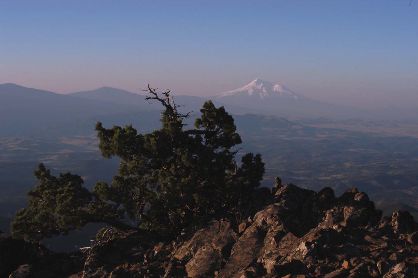
Pilot Rock, a prominent volcanic plug, demonstrates how differential erosion shapes the monument's relief.
Elevation (m)
2000
1735
1470
1205
940
675
From valley floors at 2,215 feet (675m) to Mt. Ashland's peak at 6,562 feet (2000m), elevation creates distinct soil zones. Shallow soils form on steep slopes while deep accumulations develop in protected valleys.

Elevation Zones

Mt. Ashland
6,562 ft
Mid Slopes
4,500 ft
Valley Floor
2,200 ft

Parent Material: The Foundation

The geological substrate from which soils develop provides the initial minerals and strongly influences soil chemistry, texture, and fertility.

The monument sits at the junction of three mountain ranges, each with distinct geological histories. This convergence creates an extraordinary diversity of parent materials:

Volcanic

Ash deposits and lava flows from the Cascade volcanoes, including Mount Mazama's eruption that created Crater Lake

Colluvial

Gravity-deposited materials from hillslopes, creating mixed soils with angular rock fragments

Alluvial/Fluvial

Stream-deposited sediments in valleys and river terraces, typically well-sorted and fertile

Lacustrine

Fine-grained lake bed sediments from ancient water bodies (not always basin), often clay-rich and poorly drained

Mountainous

Residual materials weathered in place from bedrock on steep slopes and ridgetops

Parent materials from three converging mountain ranges create a complex geological foundation. The diverse parent materials—from volcanic ash to river deposits—directly influence soil properties across the monument.
Lost Creek Falls
Water shapes the landscape, depositing alluvial materials in valleys and exposing bedrock in waterfalls like Lost Creek Falls.

Time: The Fourth Dimension of Soil

Time transforms fresh rock into deep, weathered soil profiles. From ancient ocean floors to recent volcanic eruptions, each layer tells a story millions of years in the making.

The monument's soils range from recent volcanic deposits less than 10,000 years old to ancient surfaces that have been weathering for over a million years. Soil formation rates are extremely dependent on specific conditions, but generally slow.

10-100 years

Initial Stage

Lichens and mosses colonize bare rock, beginning physical and chemical weathering

100-1,000 years

Young Soils

Thin A horizon forms, Entisols develop with minimal profile differentiation

1,000-10,000 years

Developing Soils

B horizons appear, Inceptisols and Andisols form with visible soil structure

10,000-100,000 years

Mature Soils

Deep profiles with clay accumulation, though maturity is complex and non-linear

>100,000 years

Ancient Soils

Highly weathered profiles, some Vertisols with shrink-swell clays

Deep Geological Time

While Earth's first soils appeared over 3 billion years ago, the deep, complex soils we see today have only existed for about 500 million years. The monument's geological history spans from ancient ocean floors to recent volcanic eruptions:

150 million years ago

Oceanic Foundation

The Klamath Mountains, including parts of the monument, formed as ocean floor sediments and volcanic islands collided with North America

40 million years ago

Cascade Volcanism Begins

Subduction of the Juan de Fuca Plate initiates Cascade Range volcanism, adding volcanic parent materials to the region

15,000 years ago

Post-Glacial Soil Development

As Ice Age glaciers retreated, modern soil formation began on freshly exposed surfaces

7,700 years ago

Mount Mazama Eruption

The eruption that created Crater Lake deposited ash across the monument, forming the parent material for today's Andisols

Present Day

Ongoing Evolution

Soils continue developing through weathering, erosion, and biological activity at rates of inches per millennium

View from Boccard Point
View from Boccard Point, revealing layers of geological history exposed by millions of years of weathering.

Soil Profile Development Over Time

Bedrock
Initial (0-100 years)
A
C
R
Young (100-1,000 years)
A
B
C
R
Developing (1,000-10,000 years)
O
A
E
Bt
C
Mature (>10,000 years)
O: Organic layer A: Topsoil E: Leached zone B: Subsoil C: Parent material R: Bedrock
Pilot Rock
Pilot Rock, a volcanic plug, stands as a testament to the monument's volcanic parent materials and differential erosion.

The Seven Soil Orders of the Monument

Soil taxonomy classifies soils into 12 orders based on their properties and formation processes. The monument hosts 7 of these orders, each representing different environmental conditions and stages of development.

From young volcanic soils to ancient weathered profiles, these seven orders tell the story of the monument's diverse landscapes and the processes that shaped them:

Distribution of the dominant soil orders across the monument, each color representing different soil-forming processes and environmental conditions. Click polygons to explore. Note: Histosols occur as minor components in wetland areas.

Mollisols

52.2% of monument

The Prairie Soils: Dark, fertile soils with thick, organic-rich surface horizons. Form under grasslands and oak savannas in valley bottoms.

  • Dark A horizon (mollic epipedon)
  • High organic matter (>3%)
  • Among world's most fertile soils
  • Excellent structure and tilth

Inceptisols

30.9% of monument

The Developing Soils: Young soils with weakly developed horizons. More developed than Entisols but lacking the specific features of other orders.

  • Beginning B horizon formation
  • 1,000-10,000 years old typically
  • Wide ecological range
  • Common on moderate slopes

Andisols

11.1% of monument

The Volcanic Soils: Young soils formed from volcanic ash and other volcanic materials. The 7,700-year-old Mount Mazama (Crater Lake) eruption provided much of their parent material.

  • High water-holding capacity
  • Low bulk density (often fluffy)
  • Rich in volcanic glass
  • High phosphate retention
  • Very fertile when young

Vertisols

5.6% of monument

The Shrinking-Swelling Soils: Clay-rich soils that shrink when dry and swell when wet, creating deep cracks and mixing soil layers through time.

  • Over 30% shrink-swell clays
  • Deep cracks in summer
  • Can exhibit self-mixing (pedoturbation)
  • Challenging for construction

Alfisols

0.2% of monument

The Forest Soils: Moderately weathered soils typically found under deciduous forests or mixed vegetation. They have a clay-enriched B horizon (argillic) and high base saturation.

  • Form under 10,000-100,000 years
  • Very limited presence in the monument
  • Support productive forests
  • Good water and nutrient retention

Entisols

<1% of monument

The Young Soils: Recently formed soils with little or no profile development. Found on steep slopes, recent deposits, or areas of active erosion.

  • Less than 10,000 years old (can be old in arid areas)
  • Minimal horizon development
  • Minor presence in the monument
  • Properties reflect parent material

Histosols

<1% of monument

The Organic Soils: Soils composed primarily of organic material, formed in wetlands where saturated conditions slow decomposition. Found in bogs, marshes, and seeps.

  • High organic matter content (>20-30%)
  • Form in persistently wet environments
  • Rare in the monument (non-dominant component)
  • Important carbon storage and water filtration

Soil Texture and Particle Classes

The physical properties of soils—their texture and particle size distribution— determine water retention, nutrient availability, and plant growth potential.

The monument's diverse parent materials create soils ranging from coarse, rocky textures in steep terrain to fine, clay-rich soils in protected valleys. Each texture class supports different plant communities and ecological functions:

  • Fine textures: Clay-rich soils with high water retention
  • Coarse-loamy: Well-drained soils with balanced drainage
  • Loamy-skeletal: Rocky soils with excellent drainage
  • Medial: Volcanic soils with unique properties

Texture Determines Function

Different soil textures create unique growing environments, from drought-tolerant plants on coarse soils to moisture-loving species in fine-textured areas.

Soil texture classes across the monument. Different colors represent particle size distributions from fine clays to coarse sands.

Serpentine Soil Adaptations

Andisols - Volcanic ash soils
Inceptisols - Young mineral soils
Ultisols - Highly weathered soils

Soil Chemistry

Understanding soil chemistry—from carbon storage to pH levels—reveals how these soils support plant life and store essential nutrients.

Scientists examine properties at different depths to understand how water, nutrients, and organic matter move through the profile. Two key properties tell important stories:

Organic Carbon Storage

The monument's soils store significant amounts of carbon in organic matter, playing a crucial role in nutrient cycling and carbon sequestration. Darker areas show higher carbon content.

Soil Acidity

pH levels vary dramatically across the monument, from acidic forest soils (blue-green) to more neutral grassland soils (yellow-green), each supporting different plant communities.

Organic Carbon (g/kg)
- - - - -

Explore by Depth

Surface 0-5 cm
Shallow 5-15 cm
Moderate 15-30 cm
Deep 30-60 cm
Deeper 60-100 cm
Deepest 100-200 cm

The Serpentine Challenge

The Klamath-Siskiyou region contains North America's largest serpentine area, where toxic soils have created islands of endemic species found nowhere else on Earth.

Serpentine soils, derived from ultramafic rocks formed deep in Earth's mantle, present one of nature's most extreme challenges for plant life. These soils are characterized by toxic levels of heavy metals, severe nutrient imbalances, and a hostile chemistry that excludes most plant species.

Extreme Chemistry

Ca:Mg ratio: Low (often < 1) — a traditional indicator of serpentine stress, though plant response varies by species
Nickel: Up to 3,800 µg/g
Chromium: Primarily Cr(III), the less toxic trivalent form naturally found in ultramafic rocks (EPA)
Nitrogen: Severely limited

Plant Survival Strategies

Hyperaccumulators: Concentrate metals in leaves
Metal excluders: Block toxic uptake
Carnivory: Darlingtonia captures insects for nitrogen
Stunted growth: Trees become shrubs to survive

Endemic Species

Epilobium siskiyouense Eriogonum alpinum Darlingtonia californica Streptanthus howellii

Over 140 endemic species adapted to serpentine

Cascade-Siskiyou National Monument landscape
Serpentine Challenge: Over 140 plant species have evolved to survive in these toxic soils, creating one of North America's most remarkable examples of adaptive evolution.

Explore the Data

You've journeyed through the complex story of the monument's soils—from their ancient geological origins to the living ecosystems they support today. Now it's time to explore this data yourself through our interactive mapping tools.

The Cascade-Siskiyou Soil Explorer puts professional-grade soil survey data at your fingertips. Click anywhere on the map to see detailed soil profiles, examine properties at different depths, and discover how climate, organisms, relief, parent material, and time have shaped every acre of this remarkable landscape. Whether you're a student, researcher, land manager, or curious naturalist, these soils have stories waiting to be discovered.